Calculating and Saving length for Bundle Heights#
The Distance Calculation and Saving feature in VASCilia allows for precise measurements of distances between labeled points in 3D cochlear datasets. This functionality supports comprehensive morphological analysis and downstream applications.
Key Features#
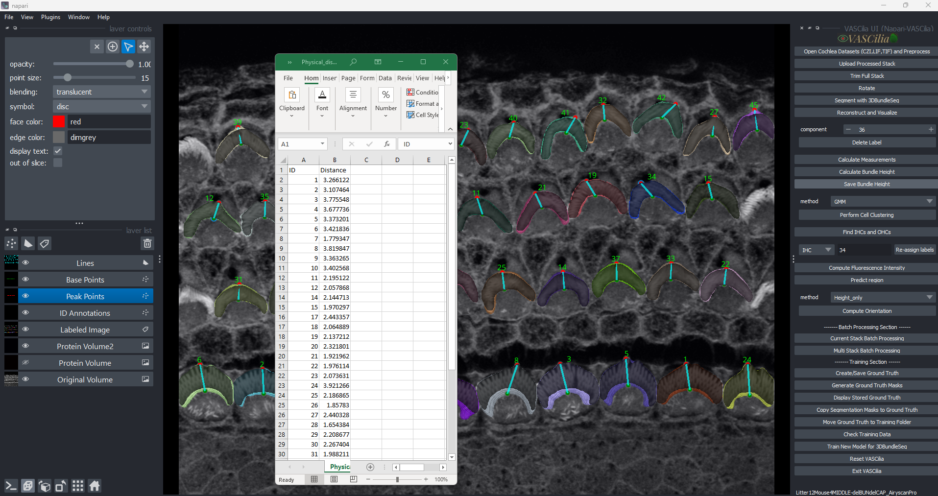
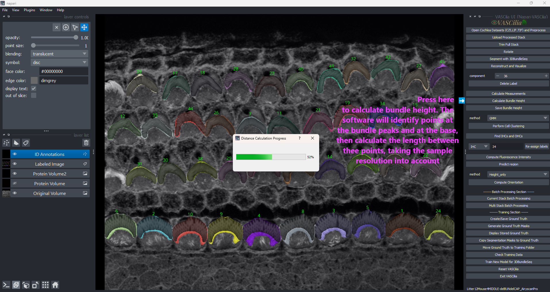
### Bundle Height Calculation - Calculates length between peak and base points for each labeled region in 3D space. - Utilizes physical resolution settings to compute real-world distances.
Steps in Calculation: 1. Identifies the Peak Point:
The highest point of a labeled structure along the z-axis.
Identifies the Base Point:
The centroid or bottom-most point in the structure.
Erosion Filtering: - Applies binary erosion to refine the structure.
Computes Distances: - Uses the Euclidean formula adjusted by the dataset’s physical resolution.
### Length Saving - Uses the physical resolution values (already saved when the opens the image). - Calculates distances in micrometers and saves them in a CSV file. - Outputs stored in a Distances folder within the dataset directory.
Saved Data: - CSV file: Contains labeled IDs and their corresponding distances. - Updated Points: Saves updated start and end points for further analysis.
Usage Instructions#
### Length Calculation 1. Initiate Calculation:
Click the Calculate Bundle Height button in the plugin.
Monitor Progress:
A progress bar indicates the calculation status.
Output:
Start and end points are visualized in Napari with labels.
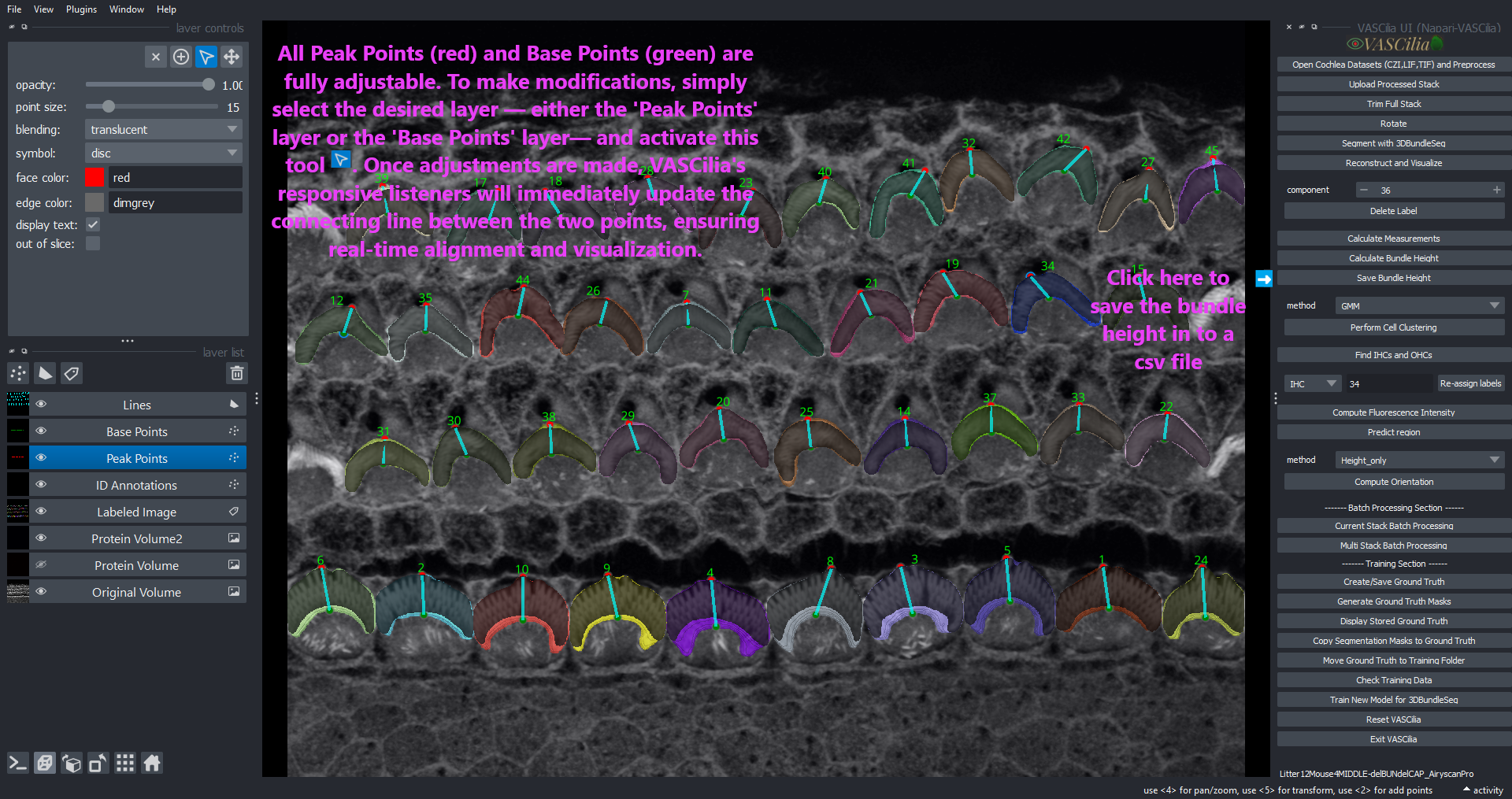
### Length Saving 1. Save Results:
Click the Save Bundle Height button to save calculated distances.
Access Output:
Navigate to the Distances folder for results.
### Visualization - Peak and base points are displayed with colored annotations:
Red for peak points.
Green for base points.
Cyan lines connecting the points.
Example Workflow#
Click Calculate Bundle Height to compute distances between peak and base points.
Review the calculated points: - Peak Points (Red) and Base Points (Green) are adjustable. - Listeners are set up to allow users to interactively move these points in the Napari viewer.
Note: Adjustments to the points will not update the distances in the CSV file automatically.
Click Save Bundle Height to save the new measurements and update the CSV file.
Use the saved data for downstream analysis or reporting.
Extending the Functionality#
To add or modify functionality, edit the following files:
calculate_distance.py and
save_distance.py
—
—
—